
- Europe
- Switzerland
- Switzerland (general)
- Batänja
-
 Search
Traveling Luck for Batänja Switzerland (general), Switzerland 
 Explore around
Batanja?
Explore around
Batanja? Wikipedia near Batanja
 Where to stay near Batänja
The timezone in Batanja is Europe/Zurich
Morning Sunrise at 04:30 and Evening Sunset at 20:09. It's light
Rough GPS position Latitude. 46.9000°, Longitude. 9.5000°
Morning Sunrise at 04:30 and Evening Sunset at 20:09. It's light
Rough GPS position Latitude. 46.9000°, Longitude. 9.5000°
Weather near Batänja Last report from SAMEDAN, null 57.7km away
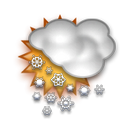 snow Temperature: 0°C / 32°F
Wind: 0km/h North
Cloud:
Satellite map of Batänja and it's surroudings...
Geographic features & Photographs around Batänja in Switzerland (general), Switzerland
populated place a city, town, village, or other agglomeration of buildings where people live and work.
- Batänja (0km)
- Pramieisters (1.5km)
- Artaschiew (2.6km)
- Haldenstein (2.6km)
- Masans (3.6km)
- Trimmis (4.4km)
- Jeli (4.5km)
- Untervaz (5.2km)
- Vättis (5.2km)
- Bläs (6.5km)
- Alt-Felsberg (6.6km)
- Neu-Felsberg (6.6km)
- Felsberg (6.6km)
- Vasön (7km)
- Tarviersch (7km)
- Zizers (7.2km)
- Ladils (7.2km)
- Ober-Says (7.6km)
- Valens (8.6km)
- Landquart (8.6km)
- Landquart Fabriken (8.6km)
- Mastrils (9km)
- Auf der Hohe (9km)
- Tretsch (9.6km)
- Domat (9.6km)
- Schluocht (9.6km)
- Maladers (9.6km)
- Igis (9.7km)
- Malans (10.3km)
- Furkels (10.6km)
- Balen (10.7km)
- Valzeina (10.8km)
- Castiel (10.8km)
- Pfäfers Dorf (11.5km)
- Ueberlandquart (12km)
- Praden (12.1km)
- Reichenau (12.2km)
- Tamins (12.2km)
- Egga (13.1km)
- Malix (13.1km)
- Sankt Martin (13.3km)
- Bad Ragaz (13.5km)
- Bonaduz (13.8km)
- Tschiertschen (13.8km)
- Jenins (14km)
- Grüsch (14.4km)
- Churwalden (15.2km)
stream a body of running water moving to a lower level in a channel on land.
- Plessur (4.3km)
- Landquart (10.3km)
- Hinterrhein (12.2km)
- Vorderrhein (12.2km)
- Tamina (15km)
mountain an elevation standing high above the surrounding area with small summit area, steep slopes and local relief of 300m or more.
- Hochwang (11.1km)
- Graue Hörner (12km)
- Ringelspitz (14.6km)
seat of a first-order administrative division seat of a first-order administrative division (PPLC takes precedence over PPLA).
- Chur (6.4km)
Accommodation around Batänja

5 Sup. Grand Hotel im Waldhaus Flims Mountain Resort Spa Via dil Parc 3, Flims Waldhaus

Hotel Sportcenter FĂźnf DĂśrfer Oberauweg 186D, Zizers

Golf Sporthotel Hof Maran Maranerstrasse, Arosa
administrative division an administrative division of a country, undifferentiated as to administrative level.
- Kreis Fünf-Dörfer (7.6km)
pass a break in a mountain range or other high obstruction, used for transportation from one side to the other [See also gap].
- Kunkelspass (8.4km)
section of populated place a neighborhood or part of a larger town or city.
- Inner Praden (11.2km)
 Wikipedia entries close to Batänja
- Calanda (Berg) mountain g mountain
- Haldenstein city o city
- Untervaz city o city
- Taminatal landmark landmark
- Trimmis city o city
- Chur city h city
- Zizers city o city
- Churwalden city m city
- Igis city k city
- Landquart GR city l city
- Felsberg GR city m city
- Mastrils city o city
- Landquart (district)
- Domat/Ems city k city
- Maladers city n city
- Malans GR city m city
Airports close to Batänja
Samedan(SMV), Samedan, Switzerland (57.8km)St gallen altenrhein(ACH), Altenrhein, Switzerland (74.7km)
Friedrichshafen(FDH), Friedrichshafen, Germany (98.2km)
Zurich(ZRH), Zurich, Switzerland (109.6km)
Lugano(LUG), Lugano, Switzerland (126.1km)
Airfields or small strips close to Batänja
Mollis, Mollis, Switzerland (44.3km)Buochs airport, Buochs, Switzerland (96.8km)
Dubendorf, Dubendorf, Switzerland (97.6km)
Zurich met, Zurich, Switzerland (101.9km)
Alpnach, Alpnach, Switzerland (106.5km)